


Product Details
+
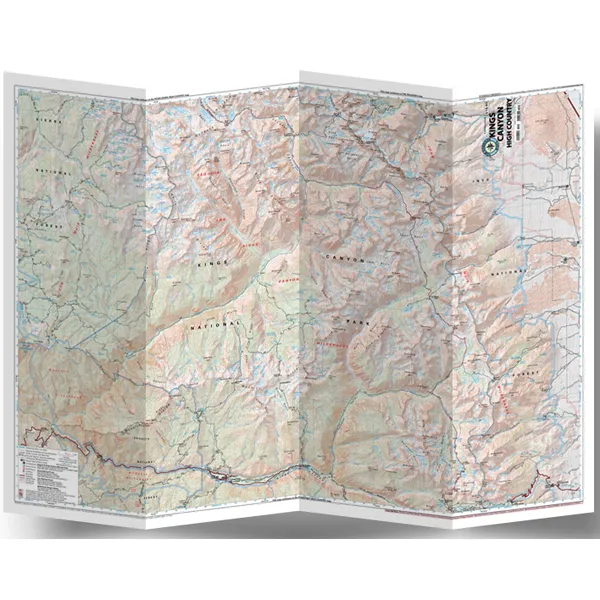
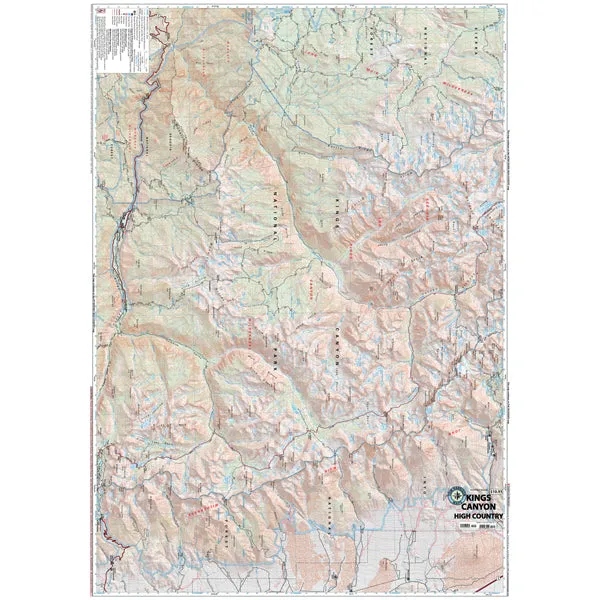
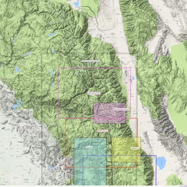
Explore miles of trails through the deep valleys and huge sequoia trees of Kings Canyon National Park with the Tom Harrison Cartography Kings Canyon High Country trail map.
- Covers the areas of Cedar Grove; LeConte Canyon; Sixty Lakes and Blackcap basins; Paradise, Crown and Tehipite valleys; and Kearsage, Glen, Pinchot, Mather and Muir passes
- Full-color shaded-relief topographic map on high-quality tear- and water-resistant paper; folds up easily and is easy to read in all conditions
- Tom Harrison maps include color-coded symbols and trails, mileage between trail junctions, UTM grids, contour lines, vegetation and elevations at trail junctions
- Folded Dimensions: 7.4 x 4.3 x 0.2 inches
- Unfolded Dimensions: 37 x 26 inches
- Map Scale: 1:63,360
- Double Sided
- Waterproof


![Carson-Iceberg, Emigrant, and Mokelumne Wilderness Areas Map [Eldorado, Humboldt-Toiyabe, and Stanislaus National Forests]](https://www.offtoadessentials.shop/image/carson-iceberg-emigrant-and-mokelumne-wilderness-areas-map-eldorado-humboldt-toiyabe-and-stanislaus-national-forests_5yTEW1_300x.webp "Carson-Iceberg, Emigrant, and Mokelumne Wilderness Areas Map [Eldorado, Humboldt-Toiyabe, and Stanislaus National Forests]")
")


